News
Rain pattern staying around
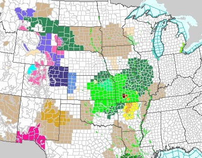
The western and central Corn Belt are getting pounded with recurring rain, and severe weather at times, with no let-up in sight.
Brownfield meteorologist Greg Soulje says it’s part of the
unseasonal El Nino system happening right now, “Some of the spots through eastern
and central Kansas, central and eastern Oklahoma and moving into the ArkLaTex
and the western sections of Missouri, already some spots better than FIVE
inches and probably another two-to-three coming. And that’s just in the short
term, over the next 25 to 36 hours.”
Soulje says a planting window might open up in parts of the eastern Corn Belt later this week, “And, it will be that, maybe, portion of Indiana and Ohio, despite recent rains. They could very well get another little window of opportunity around at least a scattering of shower and thunderstorm activity.”
Soulje expects the rain pattern to continue in most of the Corn Belt past Memorial Day. Soulje says the only place it’ll be drying and warming up is the southeast.


